Outdoors and Skills
Finding your way when your phone has no signal
Losing signal is rarely the emergency. The trouble starts when you need directions and find out the map lives on a server you can no longer reach. The fix happens at home, before you leave: save the maps to the phone, carry a paper backup, and leave your route with one person who will notice if you are late.
Two one-page guides go with this article. The day-hike ten essentials puts navigation first on the National Park Service's list, and ten fix-it skills every household should have covers the other half of being self-reliant.
Save the map while you still have signal
A phone can still show where you are with no cell service, as long as the map is already on it. The National Park Service says its free NPS App keeps showing your location on a saved park map without service, and Google Maps lets you download an area for offline use.
- In Google Maps, tap your profile picture, then Offline maps, then Select your own map, and drag the box over everywhere you plan to go.
- Offline driving directions work only if the whole route sits inside the area you saved. Walking, biking and transit directions do not work offline.
- Saved areas expire. Google Maps tries to update them on Wi-Fi once they are 15 days or less from expiring, and you can turn on auto-update in the Offline maps settings.
- In the NPS App, open the park and choose to save it for offline use before you arrive. Most of the content then works without internet.
GPS running all day drains a battery fast, so the Park Service puts a spare phone battery on its navigation list.
Carry paper anyway
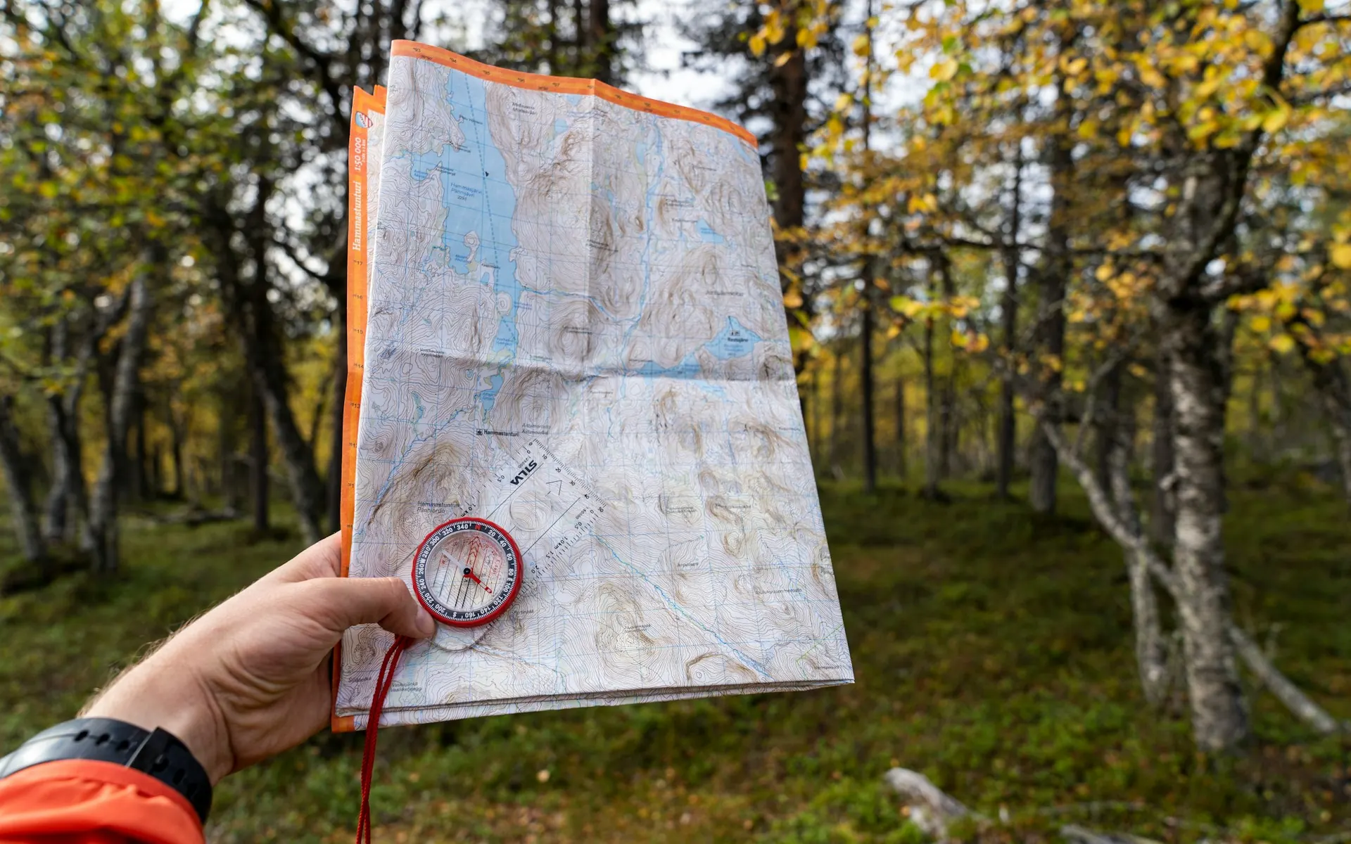
The Park Service lists a paper map as the backup for any hike, and the Forest Service warns that GPS units can lose signal or run out of battery. For trails, the U.S. Geological Survey offers free topographic maps through topoView and The National Map, plus free custom maps centered wherever you like through topoBuilder. Print one at a print shop, or order paper maps from the USGS Store. For driving, a state map and a county map in the glovebox cover the day the phone gives out.
Mark the map before you leave: where you parked, the route you plan to take and the nearest road out.
Compass basics
A compass tells you which way to turn the map so it matches the land. The USGS method:
- Lay the compass on the map with its edge along the map's north-south border.
- Turn the dial so N on the ring lines up with north on the map.
- Adjust for declination, the difference between magnetic north and true north where you are. Many compasses have a setting for it.
- Turn the map and compass together until the red needle sits inside the orienting arrow.
- Step away from metal, including rebar in concrete, which pulls the needle.
Now the hill on your left should be the hill on the left side of the map. Practice once in a park near home. The Park Service is plain about this: learn the map and compass before you go.
Let landmarks do the work
Before you start, find the big things you will pass: a ridge, a creek, a water tank, a power line, a road crossing. At each junction, turn around and look back, because the trail looks different on the way out. Take a photo of your group at the start, as the Park Service suggests, so you can show anyone helping you what everyone is wearing. And follow the Forest Service's simplest rule: if you are on a trail, stay on it.
Leave the plan with someone
This is the step that brings help when everything else fails. The Forest Service lists what to share:
| Tell them | Why it helps |
|---|---|
| Where you are going and which trail | Searchers start from your route, not a guess |
| When you expect to be back | They know when late becomes a problem |
| Your car and where it is parked | The trailhead is the first place anyone checks |
| How many people are with you | Rescuers know who they are looking for |
Agree on a time when they should start calling, and tell them if the route changes.
If you are lost: STOP
The Forest Service uses four words.
- Stop. As soon as you think you may be lost, stop, stay calm and stay put. Panic is the bigger danger.
- Think. Go back over how you got here and which landmarks you should be seeing. Do not move until you have a reason to take a step.
- Observe. Get out the map and compass and work out direction from where you are standing.
- Plan. Weigh the options before you move. If you are not very confident in the route, staying put is the better choice.
Stay where you are if it is getting dark, you are hurt or you are close to exhaustion. The Park Service's outdoor emergency plan says to stay put unless something nearby is an immediate threat, find shelter, stay warm and ration your supplies. Do not build a fire during high fire risk or wildfire season.
Make yourself easy to find. The Park Service suggests three blasts on a whistle, repeated after a pause, an SOS pattern with a flashlight, or mirror flashes toward aircraft.
When a bar comes back
If any signal returns, call 911. Have ready what the Park Service says responders need: GPS coordinates from your phone if you can get them, where you started, your last known location, nearby landmarks, what you are wearing, what gear you have and any medical conditions. In some counties, including Orange County, you can also text 911 if calling is not possible. Orange County's guidance is call if you can, text if you can't, and put your location and the kind of help you need in the first message.
Then stay where you are, so the location you gave stays true.
Sources
- National Park Service: The Ten Essentials
- National Park Service: Make an outdoor emergency plan
- National Park Service: Outdoor Emergency Plan (PDF)
- National Park Service: The NPS App (offline use)
- USDA Forest Service: If you get lost
- Google Maps Help: Download areas and navigate offline
- U.S. Geological Survey: How do I find, download or order topographic maps?
- U.S. Geological Survey: How to get your map and compass to face the same direction
- Orange County Fire Authority: Text to 9-1-1
Get the free 72-Hour Readiness Plan